Drones in agriculture and related environments.

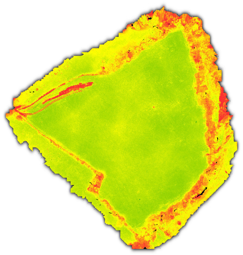
Drones in agriculture. From mapping areas, to modelling fields and buildings, as well as livestock management and crop scouting. Drones can be extremely useful in providing data and images to owners and workers within agricultural environments.
Having completed training as Drone operators within the agricultural sector at Harper Adams University for the BASiS register, we are ideally placed to provide such services throughout Shropshire and the surrounding areas.

We are pleased to be able to supply UAV Survey, Commercial Drone Photography and other such aerial services to agricultural clients within Shropshire, Cheshire, Herefordshire, Worcestershire and Mid Wales at short notice, and other areasĀ  on an ad-hoc basis.

Drone view of farm buildings

Agricultural drone mapping.

At one level, we can provide orthophoto images of fields, composed of multiple images taken from our UAVs, and from these we can provide Digital Elevation Models, or include contours to provide a detailed map of the field, or fields in question.

agriculture field from drones
Orthophoto of a field
drone agriculture field with contours
Orthophoto of a field, overlaid with contors
Digital Elevation Model of a field
Digital Elevation Model of a field from a drone
3d Model of a field from drone photography

Drone mapping in sporting environments.

Drones / UAVs can be very beneficial in mapping and inspecting sports fields and larger environments such as golf courses, point to point and national hunt racecourses.
It is possible to present the data collected in a variety of ways, similar to the agricultural imaging above:

drone survey of a golf sport facility
UAV survey
drone survey of a golf sport facility with contours
par3 golf map with contours from a drone
drone photography business
par3 golf Digital Elevation Map from a drone
drone produced 3d model of a golf course
par3 golf 3D Model from a drone

As with any drone imagery taken by trained operators such as ourselves, measurements can be garnered from the associated point clouds generated from the collected data as explained in our mapping and modelling page.

Multi-spectral imagery.

We have the ability to utilise drone borne multi-spectral sensors to provide indications on crop health, which can be of great use to farmers and agronomists. The imagery can also prove very useful to those people responsible for such environments as golf courses, playing fields and racecourses.

drone photography ndvi agriculture
NDVI image of a grass field from a drone
drone photography ndvi golf sport
NDVI image of a par3 golf course from a drone

This can be very useful for farmers to determine the health of their crops as well as those people responsible for the upkeep of sporting facilities and amenity land.

Our availability for mapping and modelling in the agricultural, sporting and leisure sectors.

We are available at short notice for mapping and modelling agricultural, sporting and leisure facilities in the Shropshire and surrounding areas. As well as most of the rest of the UK should the need arise.
Feel free to contact us to discuss your needs, or to find out how drones can help in managing your farmland, sports fields and amenity land.

Give us a call on (01584) 517070